Thursday, March 10, 2011

Getting Our Rocks Off: Chiricahua Nat'l Monument 3/3/11

Much to our surprise, Chiricahua National Monument made the list of the Twenty Least Visited National Monuments in 2009, clocking in at a relatively paltry 60,851 visitors. The source of our shock has much to do with what we thought was Arizona's popularity and appeal as an outdoor paradise, but also the stunning uniqueness of the site's "sky island" rock formations, beginning about 27 million years ago after the eruption of the Turkey Creek Volcano. Spewing ash over 1,200 square miles, the volcano produced heated particles that melted and cooled, cracked and shifted, and, via the usual erosive forces of ice and water, produced spires of stone that stagger the imagination with their beauty, breadth, and defiance of the ordinary. Chiricahua is a hiker's dream, and it seems more than a little odd that this has not become a mecca for the fit and the fearless. While we wouldn't be asking too much of our lungs on this visit, we can certainly understand the temptation to start on a trail, get lost, and never look back.
That said, this is not a site you can stumble upon by accident. Located 35 miles southeast of Willcox, the apparent closeness to civilization is almost laughably misleading, as one of Arizona's loneliest roads goes on and on and on, adding the unexpected treat of resembling a sun-baked roller coaster. Hungry? Low on fuel? Fill up both your belly and gas tank before heading out, as you'll encounter, well, absolutely nothing until you reach a sadistic visitor center that emptied its ancient shelves of sustenance long ago. Still, a bare cupboard is the least of the VC's problems. Let's take the ancient relic manning the register. I was damn near mummified after waiting several decades to purchase a magnet, and I'm pretty sure I was the very first person to whom she has counted back change. Hell, I'll be lucky to be upright at that age, but I'll also have the sense to know that I shouldn't be taking care of weary travelers at a national park site. I would have complained about the shabby ink pad that left our stamp appalingly light, but I'm not sure I had the patience to endure her confusing hunt for the "talking box" so that could pass along my concern.
Still, grandma was, against the odds, far from the oldest fixture at this New Deal-era visitor center. The film? Your guess is as good as mine, as I'm pretty sure a site with rocks should actually discuss said rocks. The exhibits? If your idea of informative is a grab bag of random objects from the "brand new" Civilian Conservation Corps, as well as placards using a font retired along with Joe McCarthy's career, then proceed with a toothy grin. And the computer that just might accept those eight-inch floppy discs with which one could play Oregon Trail? Who the hell knows. With so many sites getting new digs these days, clearly someone needs to take up Chiricahua's fight. Like, now.
Cheap shots aside, we're here for what the Apache called "standing up rocks." After leaving the VC, we hit the Bonita Canyon Drive, which is eight miles in length and climbs 1,500 feet in elevation before reaching its end at Massai Point. While that point produces the best views, the drive itself is packed with sights at the assorted pullouts, including the Organ Pipe Formation, Sea Captain, China Boy, and Echo Canyon. In addition to the rocks, there are endless seas of oak, ponderosa pine, and Douglas fir, along with a wilderness area that appears to extend forever. Yes, yes, we know all about the assorted hiking trails, but we would be content to stand before the Rhyolite Canyon with only the cool desert air to guide us. I hopped along the rocky path to reach the best vantage point, and I'm glad I did, as many of the rocks to my left were thinner and more striking than many seen elsewhere.
Did we stay long enough at Chiricahua? I fear not, but when you're covering the kind of ground we do in so short a time, pup tents and campfire chats are not in the cards. Everything we saw here was thrilling to be sure, but it's debatable whether we spent more time driving in than at the site itself. And to add to the frenzy, the time crunch forced us to leave nearby Fort Bowie National Historic Site in our wake, which has come to haunt us now that we know we could have driven the ranger access road instead of suffering through a three-mile roundtrip hike to the visitor center. Will we be back to right that wrong? You have been reading the blog, right? Count on it. Sooner than later. Mileage be damned.

FINAL RATING

8/10

Wednesday, March 9, 2011

Up Against the Wall: Coronado National Memorial 3/5/11

"DO NOT COME HERE!"

"It isn't worth the taxing drive on the dirt road for a whole lot of nothin'."

"Your car most likely will be broken into if it is in the Visitor Center parking lot."

"Don't even try to drive up Montezuma Pass....The Border Patrol are harsh and will follow your every move."


These are just a few warnings posted amongst the various blogs on the Web regarding Coronado National Memorial in Arizona. When looking at the Rand McNally atlas, Coronado appears to be straddling the border between the United States and Mexico with not a town or soul in sight to save you from the drug cartel that you KNOW is waiting for you if you attempt to venture here.

Rubbish.


Most of it, that is. Coronado National Memorial, approximately 25 miles south of Sierra Vista, Arizona, isn't nearly the arduous task that other bloggers led us to believe. Sierra Vista, an isolated military outpost of over 50,000, never really ends as you make your way to the memorial. Neighborhoods, sprawling ranches, and even a group of teenagers on a ROTC exercise, welcomed us on the easy drive to the site. The expected pothole-ridden dirt road nightmare turned out to be a new two-lane asphalt road that took us all of 15 minutes from "downtown" Sierra Vista.


The dark brown line in the middle of the above shot is all that separates Coronado National Memorial from Mexico. This is the fabled fence that will protect the souls of the United States (read: scared white people) from incoming illegal aliens. This fence, in our minds, is as sturdy as an iron gate behind a mine field preceded by electric chicken wire.

Only one problem with our viewpoint. The fence is made of a couple wires and a sequence of 2x8 plywoods traversing the length of this harsh landscape. A problem with the assumptions of the American people is that the majority have never ventured 200 miles from a border town. Stealing your Grandmother's Cabbage Patch Kids collection is most likely a more difficult task than scaling the border wall. Coronado lies a mere 3/4 mile from the border, and homes dot the landscape on the U.S. side, while Mexico's side near Coronado holds nary a tree, house or available shade outpost for a traveling Tejano. The border patrol does indeed scour the area on a constant basis, but given the bleak view on the Mexico side, if people want to breach the border, they will.

At the end of the short road, a small visitor center offers everything that this site could possibly entertain. Being a National Memorial, and the exact location of Coronado's crossing into (today's) United States remaining unknown, the site itself is a homage to Coronado and the invasion entrance of the European explorers and the ensuing culture clashes and bloodbaths it ultimately resulted in.
What the visitor center does exactly right is immediately immerse the tourist in Spanish times and decor. A jarring sight, when one is used to sterile centers with white walls and 70's exhibits, you enter into a space no larger than 500-600 square feet that resembles a Spanish villa.

The NPS Ranger acted as though she would have rather eaten nails than welcome us to the site. We imagined her days were spent with Border Patrol visits and the occasional lost traveler, but a smile goes a long way, Toots. The 15-minute video was a surprise. An introduction to Coronado and his ensuing demise and path to failure was a triumph for a site this small.

For you see......Coronado was scammed worse than Amway, folks.

In 1536, a group of shipwrecked Spanish explorers returned to the motherland with grandiose tales of cities, "lined with goldsmith shops, houses of many stories and doorways studded with emeralds and turquoise". The Viceroy of New Spain, intrigued by the first reports, sent Fray Marcos de Niza to scout the area further to confirm the prior explorers' tales.

Fray Marcos de Niza (apparently high on peyote) embellished the previous stories and promised Spain the wonders of Cibola, or the "Seven Cities of Gold" throughout the areas of Northern Mexico, and continuing through Arizona and New Mexico. The Viceroy, thrilled by the news of gold-covered towns, sent the official expedition led by Francisco Vasquez de Coronado to capture the land for Spain while converting any and all non-Christians along the way. 
Armed with 350 Conquistadors, several priests and Benedict Arnold Fray Marcos, Coronado set forth from Mexico's west coast in search of Cibola. Traversing through the Sonoran region of Northern Mexico, Coronado and his men traveled near the site of the now NPS memorial while continuing their search.

Liar McFibberson Fray Marcos urged the armada on, promising the gold cities of Cibola around the next bend. The Spaniards met many Native Americans along the way, stood agape at the simple adobe houses and people who knew only the gold of the maize they grew in the fields, but pressed on. Jon Lovitz Fray Marcos was finally figured out and shipped back to Mexico City.

However - the Native Americans stepped in and fueled the fire. Coronado was then informed that Cibola did indeed exist but was found in the region of present-day Kansas. Coronado led his men through the prairie, not assuming that the Natives led them to the land in hopes of driving them to starvation. Cibola, alas, was never discovered (unless one counts Las Vegas), and Coronado lived out his short, remaining life in failure and ridicule (much like the person in the picture below.) A newfound respect for Conquistadors was discovered after draping myself in Chain Mail. Weighing no less than 40-50 pounds, I had difficulty breathing and moving without distress.


After leaving the visitor center, we decided to travel the "Nature Walk" directly outside the center. We wanted to step into Coronado's shoes and push through the natural environment of the borderlands.

What you see above you is the entirety of the Nature Walk at Coronado NM. 100 feet of prickly pear and yucca "wonder" is all the casual tourist is afforded. We look around confused thinking, "Did we miss something?"

There are two other attactions available for the visitor here. Coronado Cave, a small limestone depository can be reached after hiking 3/4 of a mile straight up (we'll wait for you in the car) and a drive up the aforementioned Montezuma Pass. The unpaved road takes the traveler over the mountains and 55 miles to the town of Nogales, AZ. We began the trek, and 200 feet up the road were immediately tracked by a Border Patrol car. Being whiter than the dude in "Powder", he didn't give us much of a second look, but we heeded the warning and turned back.

Coronado National Memorial is undeserving of the poor press others have given it in the past. There are not activities or hikes available to visitors, but the reality of the location is always at hand. It is inevitable that one thinks of Juarez rather than Coronado at this memorial while visiting, but it is worth the time and very little effort it takes to get here.

Can we interest you in a Cibola Pyramid Scheme by any chance????

FINAL RATING

5/10

Tuesday, March 8, 2011

Mission Accomplished: Tumacacori Nat'l Historical Park 3/4/11

For reasons unknown, Tumacacori National Historical Park beckoned like nothing else on our recent visit to the Grand Canyon State. Odd indeed, given that the site features nothing by way of the usual sun baked landscapes, but rather the ruins of a 19th century mission whose construction began in 1800 and, despite fits and starts, was never fully completed. We are not the type to be awed into reverential silence by religious imagery or architecture, but pictures of Tumacacori have always possessed a quiet beauty, as if a once bustling symbol of Spanish domination and conversion had been hastily abandoned and left to die in the cruel heat of the desert. It seems fitting, too, that this tool of oppression fell victim to revolution, war, and poverty, given that few could defend Christianity's legacy regarding the native peoples of the early Americas. Father Eusebio Francisco Kino, deemed the "founding father" of the mission despite never having been a resident priest, would not have been satisfied with Tumacacori's ultimate end, but perhaps he might approve of its resurrection via the National Park Service.
Driving within earshot of Nogales for the second time in as many years, we once again righted a wrong and, instead of sailing by obliviously, pulled off the highway for our long-delayed date with this humble mission. I'll admit to a giddy excitement as we ambled into the visitor center, as it seemed that of all the "skips" from 2009, this one hurt the most. We were here at last, and couldn't wait to get inside. The visitor center (built in 1937), though small, opens onto a charming patio garden, along with a small room housing what has been described as one of the most bizarre videos in the entire NPS system. As usual, it went unwatched, largely because we had to catch the ranger before he moved too far along on his tour. Blue hairs swarmed to his side, but we still decided not to wait until the next run. Before the tour, though, is that first glimpse of the ruins. Though relatively small and far from grand (compared to the San Xavier mission up the road, of course), it retains a charm unmatched by the more ostentatious odes to the Almighty. Perhaps it's the unfinished bell tower (the dome was never built), or even the surrounding wall that isolates the site from any outside intrusions, but whatever it is, Tumacacori is ultimately most successful in transporting visitors to a specific time and place and giving modern eyes an insight into life as it was once lived.
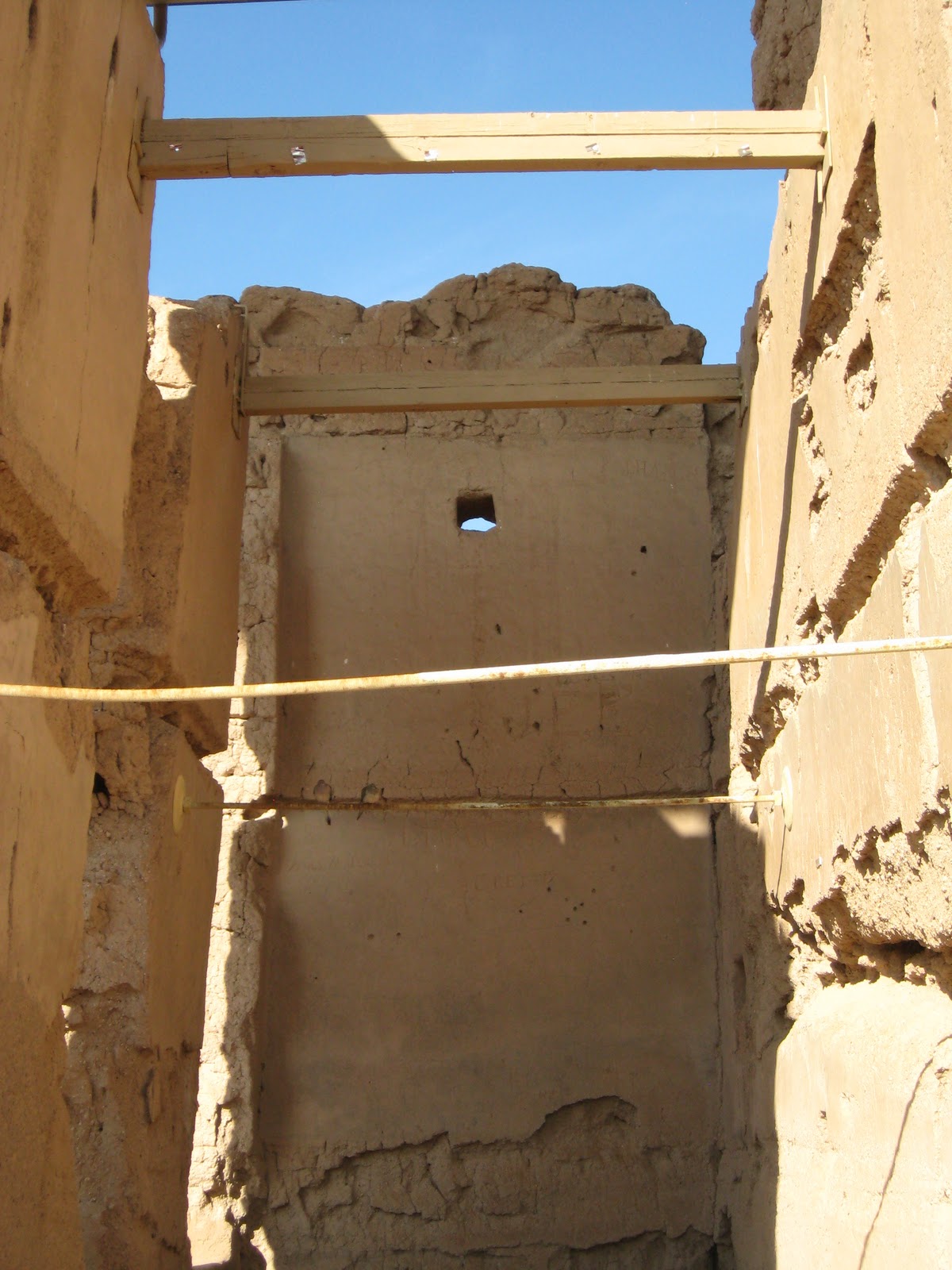
Once inside, it's not hard to imagine a service from centuries past, and despite reinforcements to the roof, the walls retain the wear and tear of time's ultimate cruelty. Because the site is only around 200 years old, the modern touches are a stark contrast to the usual ruins we encounter, which flirt with a millennium of existence. To the park service's credit, there is neither celebration nor damnation here, avoiding the predictable rants about Catholicism and Native Americans in favor of mere presentation. Religious men lived here, attempted, and often succeeded, at conversion, and then, in a historical flash, were gone. Missionaries remain, as do the churches and landmarks that testify to their faith, but here, in land that once belonged to Spain (then Mexico) until the Gadsden Purchase of 1853, is a symbol of failure. It's as if it stands as a reminder that the proud and the powerful always, in the end, meet the same fate as the most common and humble.
Upon leaving the main structure, one can see other, less dramatic buildings preserved by the NPS, some of which are reproductions and "filler." There's a reconstructed O'odham abode, cemetery, morturary chapel, lime kiln, and convento (priests' quarters), and though they pale in comparison to the church itself, they help fill out the park with a sense of community. People once lived and worked here, and though committed to a cause considerably sinister to these eyes, we can appreciate any devotion that required living and dying in such a remote desert outpost. There's a reassuring calm to Tumacacori that so many sites - even good ones - lack, and we left pleased with the fulfillment of a goal. As if to add an unexpected cherry to our day, the site's museum was shockingly decent, succeeding where so many fail. Others can learn from its insistence on explanation and updated materials, much as we all can learn from Tumacacori's rise and inevitable fall.

FINAL RATING

9/10

Monday, March 7, 2011

Symbol of the Southwest: Saguaro Nat'l Park 3/3/11 & 3/4/11

I am told that when visiting the Tucson area as a two-year-old, I was enamored with the saguaro cactus. This may or not may be true, or relevant, as I was also fond of dirt, avoiding bathtubs, and obsessively picking my nose. Still, some of that passion must have remained buried deep within, as I still retain an affinity for that great desert plant, still the most remarkable and unlikely we're ever likely to see. Beginning its life as a mere pin prick, it is said that "out of the millions of seeds that a saguaro produces, few plants survive to adulthood." This evolutionary heft ensures that these "chosen few" are rugged, majestic, and born tough, sometimes living as long as 150 years, towering over 50 feet in height, and weighing over 16,000 pounds. Inhabiting an environment that typically sees less than 12 inches of rain per year, the saguaro beats the odds, earning our respect and admiration for its defiance and adaptive superiority. Nothing should survive out here, we argue, yet there it stands - in numbers that boggle the imagination.
Saguaro National Park is, in reality, two separate units, each holding its own distinct set of rewards. The eastern half, the Rincon Mountain District, is set against a stark mountainside, though compromised somewhat by the ever-present community in its midst. It's a neighborhood attraction in many ways, and getting to the visitor center and loop drive is little more than a series of stoplights and teeming traffic. I suppose we should be thankful it exists at all, as the area appears to be stacked with choice property and grand estates, prompting pessimistic rants about future encroachments on the saguaro's land. The Rincon visitor center is rather forgettable, and without a film or exhibits worth a damn, it can be skipped in full once the passport stamp is secured. The eight-mile drive, however, is grand indeed, despite the obnoxious cyclists who threaten to smash into your car at every opportunity. There are numerous stops along the way, all with striking views of the endless fields of cacti. We arrived just as the sun was setting, so it made for a playful contrast of flickering light and the still achingly blue sky. Tucson can be a bitch in the summer, but this March day was just right.
The other half (Saguaro West), usually deemed superior by park experts, is known as the Tucson Mountain District, and it has the advantage of being tucked away beyond the cares of residential sprawl. Be aware that 30 miles separates West from East, and it might be a good idea to visit each one on separate days. The Western side also contains the more dynamic visitor center (with one hell of a view right between the VC entrance and the restrooms), even if the "film" is simply a slideshow. That said, once it ends, the screen rises up to reveal a park vista so enchanting you can't wait to get out there among the green giants. Once you leave the Red Hills Visitor Center, you'll need to take the Scenic Bajada Loop Drive, which is 1.5 miles of surprisingly well-maintained dirt road. There are several trails for the seasoned traveler, but we chose the more modest Signal Hill option, which led us up some moderately steep steps to petroglyphs and unbeatable views.
Refreshed by the brief walk at Saguaro West, it struck me why I love the Southwest so deeply. It's unforgiving, yes, and can overwhelm visitors with its endless stretches of road that seem to lead to nowhere in particular, but in few other places in our country can you see so many unique formations, landscapes, and colors. Again, light has a field day out here, and it's still staggering to think that so many ended up here from somewhere deemed even less welcoming to human habitation. Perhaps many of us are numb to the effects of the Saguaro because their image is so common when speaking of Arizona or the American desert, but for many of us, one isolated plant is all we ever see (and who hasn't encountered the prickly pear variety?). The Saguaro, however, living out its days where it started, among thousands of its brethren, cannot be appreciated without a direct encounter. As such, this is a true jewel of the NPS, and one to savor for a lifetime.

FINAL RATING

9/10

Sunday, March 6, 2011

Take a Left at the Arby's: Casa Grande Ruins Nat'l Monument 3/4/11

After driving right by the damn thing in May of 2009, we had to make amends. Sure, it would mean making a very long trip that much longer (try 2,400 miles in five days), but how could we come within shouting distance once again and give it the finger? Mind you, this isn't Glacier National Park we're talking about here, and we knew its reputation beforehand (reviews classify it anywhere from "ridiculous" to "silly"), but as we've said again and again, passport stamps make a person do outrageous things, including spending less time in Tucson proper to drive an hour north for what amounts to an ancient observatory protected ever so gingerly by a giant umbrella.
Located in Coolidge, AZ (and I mean IN, as it is right across the street from a Walgreens), Casa Grande's surroundings make it impossible to take that all-important journey into the past (unless the 13th century had stoplights and a Lowe's franchise), but once you drive through the gate (strangely closed at first, as this is the first time we arrived at an NPS site before it opened for the day), you're in a better mood, as what lies before you is bleak beyond belief (see below). After a short drive, one arrives at a modest visitor center equipped with far more parking spaces than should be necessary. That said, it is rumored that this place is strangely popular, I'm guessing because plump tourists can snag a burger no more than 60 seconds after wrapping up the brief tour.
"Fine", you're likely saying, "we get it.....this is not a place for isolation and detachment....What else ya got?" That blessed canopy, of course, but hold on a minute. As we now believe in discussing the visitor centers as part of this world famous blog, we should warn you that while acceptable, it's not going to blow you away with artifacts and information. After all, while there are theories about the Hohokam people and the times in which they lived, few agree on Casa Grande's meaning. Like so many ancient structures of the Southwest,  the building holds great celestial significance (nothing was simply "thrown together"), but no evidence exists regarding what exactly went on within its walls. Yes, these were people in touch with their surroundings (in the desert, you'd better be), but in many respects, modern man is left to fill in the gaps, often with romantic notions that may or may not reflect actual history. It's likely we'll never really know.
So after skipping the video (it didn't sound promising, but we probably should have given it a chance) and gazing at one of the largest pieces of pottery we've ever seen, we walked the short distance to the back door, where the lone Casa stood. You won't spend a great deal of time here (you walk up, around, and back), but once you come upon it, the size is impressive, and you're not surprised to learn that at four stories and sixty feet in length, it is the largest known structure from the Hohokam period. Fortifications have been extensive, but the site allows an up-close-and-personal visit, including the inevitable slackjawed stare at the steel and concrete canopy. Yes, the canopy. Built in 1932 to protect Casa Grande from, um, the sun (I think), it seems to serve its purpose (they say it would be gone by now without protection, though one wonders how the hell it survived 800 years without such a modern monstrosity), but in some ways, any visit becomes more about what came about in 1932 rather than what survived from 1150. Still, I walked away thinking that without the canopy, Casa Grande might seem too "minor" a monument; a lonely building dwarfed by the vast Arizona desert.
Casa Grande can't help that it lacks the dramatic setting of Mesa Verde, or lonely (but teeming) canyon of Chaco, so one should be forgiving if it doesn't take one's breath away. While the canopy strips the site of its original power, it's really no different than adding a decidedly phony kiva, and we hardly punished Aztec Ruins for including one. Still, that kiva, while not built by ancient hands, gives visitors an idea of what one might have looked like those many centuries ago, while a canopy simply keeps the rain out and the birds in. The impulse was noble, perhaps, but there's an argument to be made that if the elements had taken it away, so be it. That's a far different animal than man-caused vandalism, after all.

FINAL RATING

5/10