While the official NPS brochure links Wupatki National Monument with nearby Sunset Crater, it more than stands alone as its own distinct site, despite being the umpteenth set of ruins we've visited over the past year. Wupatki (Hopi for "it was cut long") was not established, then or now, to bore the Cales, so let's instead blame our obsessive need to acquire every stamp not nailed down in a nine-state radius. And yet, despite being almost certain to fail, Wupatki had us beyond the slot it now holds in our passport book. Anything within earshot of Flagstaff is fine with us, as it's one of Arizona's genuine delights, and at last, we were able to turn in after flying by a year earlier without a moment's thought. Wupatki won't make anyone forget Mesa Verde or Chaco, but it's nestled in such a wonderful setting that it sells itself as the ideal lead-in to its volcanic neighbor.

The history of Wupatki sounds familiar: by the mid-12th century, thousands of people inhabited the area, subsisting on the usual farming methods of the period. The community was vast, and some believe many of the residents had come from other drought-stricken areas nearby. While the village thrived, Sunset Crater erupted, improving the land's agricultural value with a thin layer of ash that "absorbed precious moisture and helped prevent evaporation." Additionally, the climate change increased rainfall, always a boon for farmers. By 1250, after the volcano went silent, the people disappeared. Where did they go? Why did they leave? As always, the site doesn't hold any real answers, but if you have any familiarity with Ancestral Puebloans (or anyone, for that matter), you know that the lack of food and water meant is was time to find a new home.


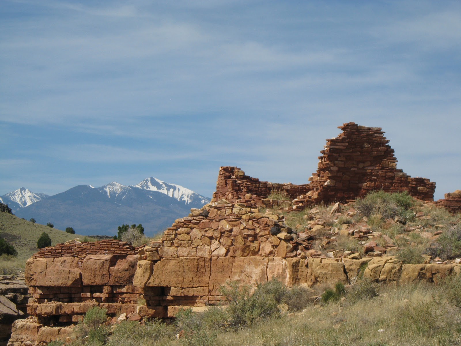
The 56 square miles of Wupatki begin with the Nalakihu, Lomaki, and Citadel Pueblos, along with the Box Canyon dwellings. All are framed by the stunning mountain vistas of nearby Flagstaff (it's like a little bit of Colorado in desert-rich Arizona), and the walks are low-key and pleasant. When the weather is this perfect (nothing worse than high winds and long trails), why not take your time? After a short drive, the visitor center awaits, though it can be quickly scanned and left behind, as I don't remember seeing any exhibits or video displays. It's just as well, for at that moment, I wanted to hear anything but that damned pan flute so omnipresent in discussions about Native peoples. Can't we just pretend these people invented rock n' roll and change things up a bit? Before we made it to the final stop, however, we decided to ignore the Wukoki Pueblo, largely because it seemed so damn far off the main artery. The map says a "2 1/2 mile
spur road", which sounds dangerous, if not deadly.


The highlight of the site is the big daddy, the Wupatki Pueblo, intersected by a 1/2 mile loop trail directly behind the visitor center. The tour is self-guiding and features numerous stops, but one can't help but be plagued by a sense of deja vu, even if I found myself transported as usual. Preservationists and the like scurried about, adding a sense of urgency to the scene, which is both barren and surprisingly beautiful. There's a logic to these ruins, and when one studies the approximation of the site in its heyday, it is quite apparent that the Puebloans understood environmental integration. These sandstone "slabs", as they are called, were combined with limestone blocks, chunks of basalt, and clay-based mortar to create sturdy, lasting structures that managed to survive hundreds of years of weather, wind, and pot hunters alike. Reinforcements are still necessary, of course (the unaware might assume these are untouched since discovery), but it's always humbling to remember that few buildings from our own time will be in such good condition 800 years hence.


No comments:
Post a Comment